Our journey now takes us through one of the highest parts of the passable Andes. We explore the Andes in a south-easterly direction as seen from Cusco, drive through the dwindling, high-altitude valleys and finally end up on the Altiplano – the high plateau – which extends as a steppe-like landscape between Arequipa and Puno. We take in a few highlights along the way – the journey is the goal, not the quick arrival.
Rainbow Mountain – Palccoyo
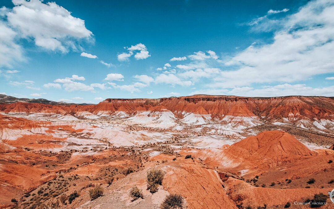
There are various rainbow mountains in the region south of Cusco. One of them, a lesser known one, is Palccoyo. After turning off the main road, we drive up the mountain on a mostly single-lane gravel road through winding curves until we finally see the first colored hills at just under 5,000m altitude. The Rainbow Mountain is actually called Rainbow Mountain because the rock appears in different colors in different layers close together. But that’s not all. The landscape itself is breathtaking. The green of light meadows alternates in stark contrast with a characteristic reddish brown. The result is a unique backdrop. And finally, we see the main attraction: the Palccoyo, the rainbow mountain.
Despite the altitude, we take the easy hike to the various viewpoints in our hiking boots. The view is simply unique. And behind the next ridge, the next slopes of the Rainbow Mountain appear. Of course, technically it’s probably a new mountain, but the underlying geological formation with its colorful layers will probably be the same.
We are glad we didn’t opt for the most famous rainbow mountain, Vinicunca, as there are very few tourists here at Palaccoyo and we are even the only ones walking the short hiking trail. So, we have nature all to ourselves here and can enjoy it in peace.
Inca bridge – Q’eswachaka
Just around the corner by Peruvian standards, we visit the Inca bridge Q’eswachaka. The most important peculiarity is that a special type of grass is used to make the bridge. At the end of the day, the Inca bridge Q’eswachaka is a grass bridge, all the supporting elements are made of woven straw. Some of the strands are twisted into really thick strands so that no visitor to the bridge falls off. An old Inca craft is still celebrated year after year, as the bridge has to be renewed every year due to rapid weathering. Many families from the surrounding area contribute handmade straw ropes to the community project. The best ropes are selected from all the thin straw ropes and processed into the thick main ropes. In many more places, the remaining thin straw ropes are used to complete the bridge as a whole.
A bridge made only of straw? Not quite. But we’ll let it count, it really is a straw bridge and requires a high level of craftsmanship. However, the walking surface of the bridge is covered with small branches, which are held together with leather straps. This protects the straw ropes from excessive wear and tear and the bridge remains accessible to interested visitors. What’s more, the bridge crosses a rocky canyon over the Apurímac River, which adds to the impressive appearance of the landscape. And additionally: understandably, to ensure that the bridge lasts a whole year, we are only allowed to cross the bridge once, one person at a time and only in one direction. We then return along the road over the modern bridge. Nevertheless, we are happy that we were allowed to cross the Inca bridge Q’eswachaka!
Waqrapukara – Inca fortress or prison
We visit another sight on our way to the Altiplano. Waqrapukara is a lesser-known and less easily accessible Inca site in the Andean highlands. Once again, we have to put up with gravel roads. But the road to Waqrapukara alone is impressive and worth the journey. We drive from the Pomacanchi lagoon via Santa Lucía to the south-western parking lot, from where we start the short hike to Waqrapukara.
The walk is reasonably quick and we arrive at Waqrapukara after about an hour. What a sight! Fortifications have been built on top of a rock formation. Whether this is a fortress or an Inca prison is a question mark. It still remains an open question, but the assumption is that cultures before the Incas had already erected fortified buildings here. And all this at the Omacha Canyon, which is carved into the rock by the same river that flows under the Inca bridge, the Apurímac. A unique landscape, not only at Waqrapukara, but also all along the way, rock towers constantly protrude from the landscape, simply because erosion is different for different types of rock. A world-class place and a world-class canyon!
After an in-depth look at Waqrapukara, we head back the way we came. Finally, our home, the campervan Ben, is waiting for us in the parking lot. And now we’re making slightly longer journeys so that we can finally reach the Altiplano, or rather our next destination a little later.


0 Comments